
Jeff Masters analyzes the latest weather data on the storm:
The latest set of 00Z (8 pm EDT) and 06Z (2 am EDT) computer model runs still have wide differences in the timing and landfall location for Sandy. The ECMWF has been very consistent in its handling of Sandy, and continues to predict that Sandy will hit Delaware or Maryland on Monday afternoon–basically the same forecast it has had for three days. Our other top model for forecasting hurricane tracks, the GFS, has been more inconsistent, and predicts a landfall on Long Island, New York on Tuesday afternoon.
Harry Enten adds:
Where the storm hits, it's going to be very bad. A more indirect hit will lead to harsh conditions and potential power outages, yet it probably won't be something that is the be all, end all. That said, we don't know where the direct hit will be, so it's important to take all necessary precautions.
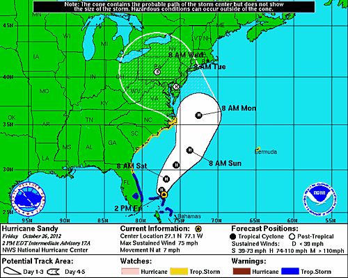
Image from the NOAA.
