David Banks posts a belated reply to Evgeny Morozov, who recently cautioned against the dangers of personalized Google maps. Banks counters that personalized maps are nothing new:
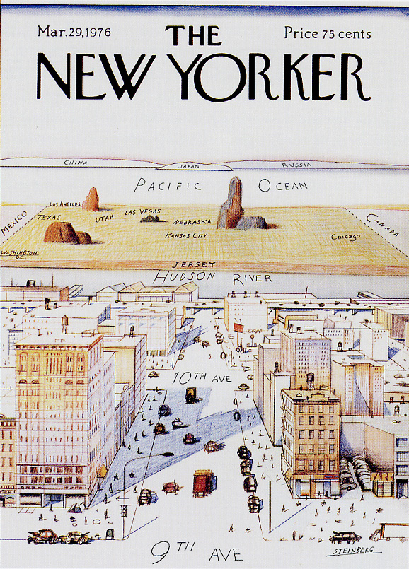
In the late 50s, MIT urban planner and architect Kevin Lynch asked residences of Boston, Los Angeles, and
Jersey City to draw a map of their city. He found that while individual maps were distorted, the distortions almost disappeared in the aggregate. One person might forget the existence of an entire boulevard or transpose the order of churches going North to South, but overall the maps were fairly accurate. Lynch, while acknowledging that his sample sizes weren’t very representative or large (30 in Boston, 15 in Los Angeles and Jersey City, all of middle and upper income) couldn’t help but comment on how strong and predictable the trends were. People with cars would see highways as smaller than they actually were (the speed of the car tends to reduce perceived distance), while pedestrians tended to exaggerate the size of the highway (because it was a nuisance and an obstacle, rather than a useful path).
Lynch concluded that we all have an “image of the city” in our minds that exaggerate salient features and actively delete places that do not serve a purpose in our daily lives. We’ve always had personalized maps, but up until recently, lacked the tools to effectively share them with each other on a consistent basis or in useful ways. Personalized Google maps, so long as they provide an opportunity for sharing, could provide some of the richest, most evocative maps to date. The over-lapping of millions of personal maps will illuminate hot public spaces and identify emerging new ones. The key here is whether or not Google lets us compare our maps. It seems like a killer social media function so there’s no reason not to.